
Land conservation cuts climate pollution quickly by keeping carbon locked in trees, roots, soils, peat, and wetlands rather than releasing it through clearing, drainage, or high-severity fire. You also boost ongoing uptake by restoring forests and rewetting peatlands with measurable baselines and MRV (plots, LiDAR, cores). Protecting core habitat and corridors reduces mortality, supports breeding, and safeguards genetic diversity. With easements, protected areas, and no-conversion rules, funding can follow verified outcomes-and there’s more ahead on where impact is biggest.
Carbon Storage 101 in Natural Ecosystems
How do forests, grasslands, and wetlands actually “lock away” carbon? You measure it in two pools: biomass and soils. Trees pull CO₂ through photosynthesis and store it in wood; field plots and LiDAR quantify tons per hectare. Grasslands store less aboveground carbon, but roots cycle carbon deep into the soil, building stable soil organic matter, which you can verify with cores and bulk density. Wetlands slow decay under low oxygen, accumulating peat; flux towers and chamber tests track methane tradeoffs while net carbon often stays positive over decades. Don’t fall for conservation misconceptions that “green cover” equals storage; disturbance, drainage, and fire reset stocks fast. Smart funding mechanisms tie payments to monitored baselines, permanence, leakage controls, and adaptive management.
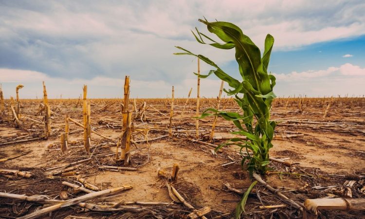
How Conserving Land Slows Warming Quickly
When you conserve land, you prevent immediate carbon release by avoiding conversion, drainage, and high-severity disturbance, which rapidly convert stored biomass and soils into CO₂. You also protect high-carbon ecosystems-peatlands, old-growth forests, mangroves-where per-hectare stocks and avoided emissions are among the highest, so policy tools like easements, protected areas, and no-drain rules deliver fast climate wins. At the same time, you accelerate natural carbon uptake by keeping intact habitats connected and well-managed, enabling regeneration and stable sequestration without the delays and risks of heavy engineered interventions.
Preventing Carbon Release
Guardrail: conserving intact forests, peatlands, grasslands, and mangroves keeps their long-stored carbon out of the atmosphere, delivering near-term climate benefits you can’t get from slow-to-scale removals. When you stop conversion, drainage, and repeated burning, you avoid a pulse of CO₂ and methane that would otherwise hit the air this decade. You can quantify this quickly: track avoided emissions using remote sensing, field plots, and verified baselines, then tie the results to contracts and compliance. Put land stewardship on the balance sheet by funding enforcement, fire management, and sustainable livelihoods that keep land intact. Use policy incentives-tax credits, performance payments, and procurement rules-to shift capital from extraction to protection. You’ll reduce risk, stabilize supply chains, and buy time for clean energy deployment.
Protecting High-Carbon Ecosystems
Because a small share of landscapes holds a disproportionate share of carbon, protecting high-carbon ecosystems-primary forests, peatlands, mangroves, and old-growth savannas-can slow warming fast. You get immediate climate benefit by avoiding oxidation and fire-driven loss from drained peat, logged forests, or cleared coasts-emissions pulses that can equal years of local energy use. In the field, you prioritize intactness, hydrology, and edge pressure, then lock in protections where carbon density and vulnerability intersect. You also watch for biodiversity shifts as temperatures rise, because fragmentation accelerates turnover and raises collapse risk. To scale action, you align policy incentives-jurisdictional REDD+ performance payments, blue-carbon credits with safeguards, and no-conversion procurement rules-so landholders keep carbon stocks standing and communities gain durable revenue streams.
Accelerating Natural Carbon Uptake
How do you slow warming quickly without waiting decades for new tech to scale? You conserve and restore working lands so photosynthesis pulls CO₂ down now. When you prevent conversion and rewet drained peat, you avoid large emissions and restart rapid uptake; when you reforest marginal acres and improve soil cover, you build carbon with measurable baselines and MRV. You can target projects with high additionality: riparian buffers, native grasslands, and improved forest management that increases stocking without sacrificing habitat.
You accelerate results by pairing land ethics with policy tools-conservation easements, climate-smart procurement, and permitting that rewards restoration. Then you unlock monetary incentives: performance payments, carbon markets with durability tiers, and insurance-backed buffers that de-risk landowners and scale adoption fast.
How Conservation Prevents Species Loss
When you protect core habitat and connect it with corridors, you cut fragmentation that field surveys link to higher mortality and lower breeding success. When you pair conservation easements, land-use zoning, and enforcement with on-the-ground management, you reduce key extinction drivers-land conversion, overharvest, invasive species, and altered fire regimes-tracked in recovery plans and threat assessments. You also safeguard genetic diversity by keeping populations large and connected, which lowers inbreeding risk and improves resilience as conditions shift.
Habitat Protection And Connectivity
Although emissions cuts dominate climate headlines, you can’t slow biodiversity loss without protecting habitat and keeping it connected across working landscapes. When you reduce habitat fragmentation and landscape fragmentation, you sustain gene flow, expand viable territories, and lower edge effects that degrade nesting and foraging. Field surveys and camera-trap networks repeatedly show higher occupancy where corridors link core patches, especially along riparian buffers and ridge-to-valley gradients. You can operationalize connectivity with policy tools that align easements, zoning, and infrastructure permits, then verify outcomes with remote sensing and telemetry.
- Map pinch points with LiDAR and Sentinel-2
- Secure corridors via conservation easements and set-backs
- Retrofit crossings where roads sever movement routes
- Track success with eDNA, tags, and occupancy models
Preventing Extinction Risk Drivers
Many species don’t slip toward extinction because of a single threat; they decline as habitat loss, overharvest, invasive predators, disease, altered fire regimes, and climate stress stack up faster than populations can rebound. You can cut that stack by pairing land protection with on-the-ground threat controls: enforce harvest limits, remove invasives, restore fire with prescribed burns, and reduce roadkill and bycatch. Field teams track occupancy, mortality, and recruitment, so you can adapt fast when indicators dip. Policy tools matter: align permits, grazing plans, and biosecurity rules across jurisdictions, and require measurable outcomes in conservation easements. With biodiversity financing, you can fund sustained monitoring and rapid-response crews, not one-off projects. Scale impact through community stewardship that rewards compliance and local knowledge.
Safeguarding Genetic Diversity
Cutting immediate threats keeps populations alive, but long-term persistence depends on the genetic diversity those survivors carry. When you protect connected habitat, you keep gene flow moving, reduce inbreeding, and raise adaptive capacity as heat, fire, and pests shift. Field studies show fragmented populations lose heterozygosity fastest, so you need corridors, climate refugia, and management that’s paced to disturbance cycles. Pair in situ protection with seed banking and ex situ conservation to hedge against catastrophic loss and to support future reintroductions under permitting and biosecurity rules.
- Map genetic hotspots before siting easements
- Fund corridor buildouts in conservation plans
- Require genetic monitoring in restoration contracts
- Store, test, and rotate collections for viability
Where Conservation Has the Biggest Impact
Where does conservation deliver the biggest return per dollar and per hectare? You get outsized gains when you target carbon-dense, species-rich places under imminent conversion: tropical peatlands, mangroves, intact primary forests, and freshwater floodplains. Remote sensing plus field plots lets you rank parcels by avoided emissions, endemic richness, and connectivity value, then stress-test results against leakage and permanence.
You’ll move fastest where policy tools already exist: Indigenous tenure, conservation easements, jurisdictional REDD+, and biodiversity credits with rigorous MRV. Treat offsets skeptically; require additionality and social safeguards to stay ahead of bioethics debates. Keep innovation grounded-AI triage, eDNA surveys, and drones cut costs-yet remember the goal isn’t space exploration; it’s measurable protection on Earth.
How Protected Lands Buffer Heat, Floods, and Fires
How do protected lands turn into frontline infrastructure when heatwaves, floods, and fires hit? You see it on the ground: intact canopies drop surface temperatures, wetlands store surge, and connected habitat breaks up fuel continuity. These benefits scale, and they’re measurable-cooler microclimates, delayed peak flows, and reduced fire intensity around boundaries.
- Map cooling corridors where trees deliver buffering heat across urban edges
- Quantify floodplain storage to boost flood resilience during 1-in-100-year storms
- Monitor soil moisture and stream temperature to flag drought and fish stress early
- Use remote sensing to track burn severity and target defensible community buffers
If you align zoning, hazard mitigation plans, and watershed rules with these functions, you turn protected landscapes into adaptive, cost-effective risk management.
Proven Tools: Easements, Parks, and Stewardship
A toolbox of proven conservation instruments-easements, parks, and stewardship agreements-lets you lock in carbon storage, habitat connectivity, and hazard buffering with enforceable terms and clear budgets. You can tailor easements to keep working lands productive while preventing conversion; monitoring clauses, baseline documentation, and remedy provisions make outcomes auditable. With easement financing, you stack public bonds, mitigation fees, and private capital to close appraisal gaps and pay for perpetual compliance.
You can deploy parks where ownership and access deliver the biggest ecological ROI-riparian corridors, climate refugia, or urban heat islands-then fund operations through dedicated levies and endowments. Finally, land stewardship agreements translate science into practice: set burn windows, grazing thresholds, invasive-control triggers, and adaptive metrics so management keeps pace with shifting climate baselines.
How to Support Local Land Conservation Projects
Why start local? Because land decisions happen parcel by parcel, you can move faster than state or federal timelines. Track priority habitats, floodplains, and heat islands, then back projects that deliver measurable carbon storage and species connectivity. Use policy levers-zoning updates, right-of-way set-asides, and conservation incentive programs-to lock in durability. Pair local funding with performance metrics so dollars follow outcomes, not slogans. Build community partnerships with tribes, farmers, and land trusts to reduce conflict and expedite permit approvals.
- Co-fund stewardship crews and monitor soil carbon, water quality, and invasives
- Support bond measures or dedicated sales taxes for acquisition and easements
- Volunteer for baseline surveys, trail counts, and biodiversity iNaturalist blitzes
- Advocate for climate-smart ordinances and transparent project dashboards
Conclusion
When you conserve land, you lock carbon in soils and forests, cut near-term warming, and keep habitats connected so species can move and survive. You also reduce disaster costs by buffering heat, floods, and fire-outcomes agencies now measure in avoided emissions and risk reduction. Use proven tools like conservation easements, parks, and stewardship agreements to protect high-impact parcels. Support local projects with votes, funding, and partnerships-because every acre counts a million times over.
